History
The land system, the moku, and the story of South Kihei.
The Ahupua'a System
For more than a thousand years, Hawaiians organized land and life through the ahupua'a — a wedge-shaped land division running from mauka (the mountains) to makai (the sea). Each ahupua'a held a complete slice of the watershed: upland forests, mid-slope gardens, lowland taro fields (lo'i kalo), and coastal fishponds, so a community could be entirely self-sufficient within its own boundaries.
Water was the organizing principle. The Hawaiian word for water is wai, and the word for wealth is waiwai — abundance of water meant abundance of food. Channels diverted stream water through engineered taro ponds that circulated flow to prevent stagnation, achieving per-acre yields roughly five times that of dryland farming. Where freshwater met the ocean, rock-walled fishponds blended nutrient-rich runoff with tides to fatten fish caught through sluice gates. The uplands, wao akua (the realm of the gods), were stewarded only by those with knowledge of the forest.

The Konohiki
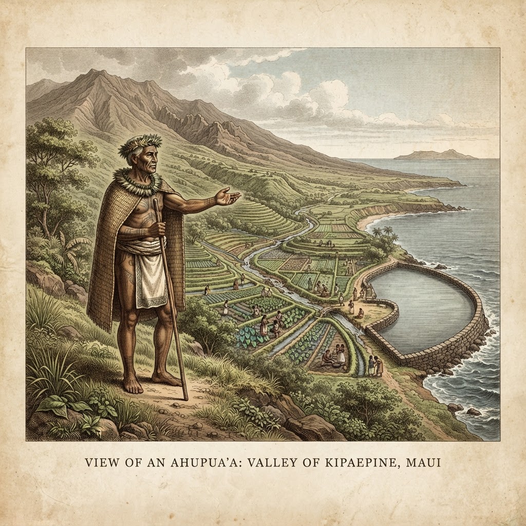
Within each ahupua'a, the ali'i (chief) appointed a konohiki — a land manager who served as the day-to-day steward of the watershed. The konohiki oversaw the cultivation of taro and other crops, organized communal labor through the hula kō (work call), regulated the taking of fish and forest resources, and collected the annual makahiki tribute of food and goods that flowed up to the chief. A skilled konohiki read the rains, the streams, and the seasons to keep the ahupua'a in balance — neither the land nor the people could be exhausted, or the whole system collapsed.
The konohiki was more than a tax collector. They held the practical knowledge of the place: which streams ran in which month, where the mullet spawned, which trees could be felled and which were kapu (taboo). They mediated disputes over water rights and access, and they were accountable — a konohiki who hoarded resources or mismanaged the land could be removed. In this way the role joined authority with responsibility: the konohiki could command labor and tribute, but only so long as the ahupua'a stayed abundant for everyone who lived within it.
The traditional konohiki system was dismantled by the 1848 Māhele, which privatized land into fee-simple parcels, and the role itself faded as Western property law replaced shared stewardship. But its logic — that the land from mauka to makai is one connected system, and that someone must hold the knowledge of how its pieces relate — never disappeared. Today a new kind of steward is emerging: the digital konohiki.
The Digital Konohiki
A digital konohiki does not manage water or fish, but information — the maps, listings, events, and connections that let a community see its own ahupua'a whole. Where the traditional konohiki knew which stream fed which lo'i, a digital konohiki knows which farm feeds which market, which business serves which neighborhood, which road connects mauka to makai. Platforms like Kamaole Living take up this role: gathering the land's story, its growers, its businesses, and its people into one shared view, so that the ahupua'a can again be understood and cared for as a single living system.
Interactive maps that show every farm, business, resource, and landmark from mauka to makai in one connected view.
A farm network and marketplace that link upcountry growers to coastal kitchens, the way the old lo'i fed the village.
Events, volunteer sign-ups, and a business directory that bring residents and visitors together around shared stewardship.
The land's history, place names, and moʻolelo kept alive and accessible, so the knowledge of the ahupua'a is never lost again.
The digital konohiki carries the old duty forward: to hold the knowledge of how the pieces relate, and to keep the ahupua'a whole — not for one chief's tribute, but for everyone who calls Kamaole home.
The Significance of Water
To the ancient Hawaiians, water was not a resource to be used — it was the source of all life and the measure of all value. The word wai means fresh water, and from it comes waiwai, the word for wealth or richness. A community that had water had everything: taro in the lo'i, fish in the ponds, and the abundance that let a people flourish. A community that lost its water lost everything. This understanding was not merely practical — it was sacred. Kāne, the foremost of the four major gods, was the deity of fresh water, and every spring, stream, and rainfall was seen as his gift. The kapu system protected water sources with sacred prohibitions, and the konohiki's deepest responsibility was to ensure that water flowed from mauka to makai without being fouled, hoarded, or wasted.
The engineering of the ahupua'a was, at its heart, water engineering. Stream water was diverted through ʻauwai (irrigation channels) into cascading lo'i kalo, where it circulated through each terrace before overflowing to the next, so that no water stagnated and every pond was both fed and cleaned. At the coast, loko i'a (fishponds) were built at the exact point where freshwater met salt, because the Hawaiians understood that the brackish mixing zone was where the richest feeding occurred. The whole system was designed around a single principle: water must flow downhill, and as it flows, it must be used, cleaned, and passed on — never stopped, never poisoned, never kept from those below.
The Hawaiian word for water is wai, and the word for wealth is waiwai — abundance of water meant abundance of food and life. Water was not a commodity but a sacred trust, a gift from Kāne, the god of fresh water, who sent the rains that fed the streams and springs.
Taro terraces (lo'i kalo) were engineered to circulate stream water through interconnected ponds, preventing stagnation and achieving per-acre yields five times that of dryland farming. Each lo'i was a living filter — the kalo roots cleaned the water as it passed through, and the overflow fed the next terrace below.
At the shore, rock-walled fishponds (loko i'a) blended nutrient-rich freshwater runoff with ocean tides. Sluice gates let young fish enter to feed in the brackish shallows, where the mix of wai and salt grew fat mullet and awa. The pond was the ahupua'a's meeting point — where mauka water became makai food.
The whole ahupua'a was organized around the path of a single drop of water — from the wao akua forest where rain fell, through the kula gardens and lo'i, down to the fishpond and reef. Every person who lived along that path had a role in keeping the water clean, because the water fed everyone below them.
Where the Old Principles Meet the Kam 1 Clean-Up & Drainage 2
The Kamaole 1 Beach Clean-Up Pilot Project and its Drainage 2 Settling Basin Network concept are not just engineering — they are a return to the ahupua'a's water logic. The ancient Hawaiians built their whole civilization around the principle that water must be caught, cleaned, used, and passed from mauka to makai. The concept design does the same thing in modern terms: it intercepts stormwater on the bare ranch slopes above Highway 31, settles out the sediment in terraced basins, stores the cleaned water for irrigation, and releases it slowly to the reef instead of in a brown flood. Each element maps directly to an ancient principle.
Kāne's rains feed the upland forest
The settling basin network begins with a mauka inlet and forebay that captures the first flush of stormwater from the Haleakalā Ranch slopes — the same rains Kāne sent to the wao akua, now intercepted before they can carry bare-soil sediment down to the reef.
Lo'i kalo circulate and clean water
Three terraced settling basins cascade down the mid-slope, each dropping finer sediment as the water slows — the same logic as the lo'i, where each terrace cleaned the water for the one below. Native sedges and ʻakulikuli planted in the retention ponds strip nutrients the way kalo roots once did.
Fishponds blend fresh and salt
A polishing wetland at the bottom of the network finishes nutrient and sediment removal before the cleaned water reaches Drainage 2 and the ocean — a modern echo of the loko i'a, where freshwater met the sea and both were enriched by the meeting.
Water feeds food, food feeds people
The retention ponds double as a gravity-fed irrigation source for dryland taro (kalo) and sweet potato (ʻuala) māla gardens — closing the loop between flood control and food the way an ahupua'a should. The water that falls on the mountain grows food for the community below.
Kapu protected the source
The concept design includes a gated flood bypass that opens only in severe storms, releasing settled, cleaned water in a controlled flow rather than a raw sediment pulse — a modern kapu on the worst the mountain can send, so the reef below is spared.
Knowledge passed to the next generation
A Kamaliʻi Elementary keiki program brings students to the learning garden to plant and harvest kalo, seeing firsthand how the mauka basins protect the makai reef — the old duty of stewardship, taught again to the children who will inherit the ahupua'a.
The Kam 1 Clean-Up and the Drainage 2 concept are, in the end, an act of remembering — that the mountain and the reef are connected by water, that the water must be cared for at every step, and that a community which tends its water tends its own future. It is the konohiki's old knowledge, written in basins and gardens and a keiki program, for an ahupua'a that is learning to be whole again.
The Hawaiian Chiefdom System
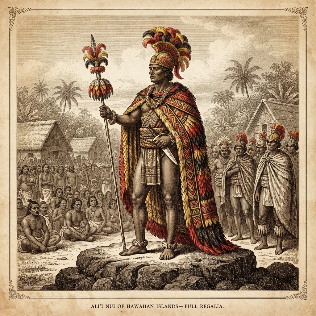
Above the ahupua'a sat a political structure as layered as the land itself. Pre-contact Hawai'i was organized into chiefdoms — each island ruled by a mo'i (supreme chief or king), with authority devolved downward through a ranked hierarchy of ali'i (chiefs). The highest were the ali'i nui, the high chiefs of chiefly lineage who could trace their genealogy back to the gods; below them, the ali'i ai moku governed the moku (districts), and the ali'i ai ahupua'a oversaw individual ahupua'a. At the working level, the konohiki managed the day-to-day operations of the land under the authority of these chiefs.
What legitimized this hierarchy was mana — a sacred, impersonal power that flowed through genealogy and acts of prowess. The ali'i claimed descent from the gods, and their mana was believed to be greater the more direct and pure that lineage. A chief's power could rise or fall with demonstrated success in war, in resource management, and in the favor of the gods; a chief who let the land fail or the people starve lost the mandate of his mana. The kapu system — the network of sacred laws and taboos — reinforced this order, marking certain things, places, and behaviors as forbidden to commoners and reserved for the ali'i, so that the social hierarchy was also a sacred one.
Below the ali'i stood a broader social order. The kahuna were the priests and experts — keepers of genealogy, astronomy, navigation, medicine, and the rituals of the heiau (temples). The maka'āinana — the commoners, literally "people of the land" — worked the lo'i, tended the fishponds, built the walls, and provided the labor and tribute that sustained the whole system. At the bottom were the kauā, a class of outcasts or war captives who served the chiefs in menial and often sacred roles. The maka'āinana were not slaves — they held customary rights to the land they worked and could appeal against a konohiki who abused them — but they were bound to the ahupua'a and subject to the chief's call for labor and tribute.
The chiefdoms were not static. Alliances shifted, marriages were arranged to concentrate mana, and ambitious ali'i launched campaigns to unite islands or seize districts. By the late 18th century, the island of Hawai'i's Kamehameha I would consolidate the archipelago into a single kingdom — but the underlying structure, from mo'i down to konohiki, had organized Hawaiian life for centuries before that. For Kamaole, the chiefdom system meant that the ahupua'a was never an independent village but a link in a chain of authority: the land fed the people, the people owed tribute to the konohiki, the konohiki answered to the ali'i, and the ali'i answered to the gods whose mana gave them the right to rule.
The Kapu System
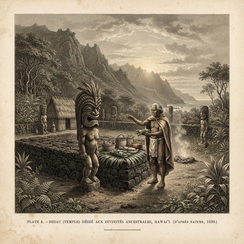
The kapu system was the sacred law that held Hawaiian society together — a web of taboos governing everything from what could be eaten to who could walk where, from when fish could be caught to which trees could be cut. The word kapu means both "sacred" and "forbidden," and the two meanings were inseparable: a thing was forbidden because it was sacred, and sacred because it was forbidden. The kapu did not merely regulate behavior — it organized the whole cosmos, binding the ali'i to the gods, the people to the land, and the land to the seasons.
The most visible kapu were the ʻai kapu, the eating taboos that separated men from women. Men and women could not eat together, and women were forbidden from eating certain foods — pork, banana, coconut, and most reef fish — that were reserved for the gods and for men. A separate cooking fire and eating house was kept for women. The ʻai kapu encoded the belief that men's eating was a sacred act of communion with the gods, and that women's presence would pollute it. The taboo was so absolute that its violation was punishable by death, and it shaped the daily architecture of every household: separate hearths, separate houses, separate paths.
Beyond the eating taboos, the kapu organized the social hierarchy. The ali'i were surrounded by kapu that set them apart: their shadows could not fall on commoners, their possessions could not be touched, and certain words and names were reserved for them alone. When an ali'i walked, commoners prostrated themselves; when an ali'i nui died, the land went kapu — a period of absolute prohibition when no one could move, speak, or work until the new chief's kapu was declared. The kapu made the chiefly order not just political but cosmic: to defy the ali'i was to defy the gods whose mana authorized them.
But the kapu was also a system of ecological regulation, and this is where it touched the ahupua'a most directly. Fishing kapu closed certain grounds during spawning seasons so stocks could recover; forest kapu restricted the cutting of certain trees — especially the giant koa used for canoes — to the konohiki's permission, so the upland canopy was not stripped bare. Some kapu rotated through the year, opening and closing different resources as the seasons turned, so that no single ground or species was harvested continuously. The makahiki festival, running from late October through January, lifted many kapu and imposed others: war was forbidden, tribute was collected, and certain lands became kapu for the duration. In this way the kapu wove conservation into religion — the land was not exploited freely but used within sacred limits that kept it productive across generations.
The kapu was enforced by the kahuna — the priests who served as the religious and judicial authority of the chiefdom. The kahuna pule (praying priests) conducted the rituals of the heiau, and the kahuna ʻanāʻanā (sorcery priests) were said to pray people to death for kapu violations. But enforcement was also practical: the konohiki and the ali'i could order punishment, and the penalty for a serious kapu violation was typically death, often by clubbing or strangulation, with the body displayed as a warning. The severity was not cruelty for its own sake — it reflected the belief that a broken kapu endangered the whole community's relationship with the gods, and that only its swift punishment could restore the balance.
The kapu system collapsed in 1819, less than a year after the death of Kamehameha I. His son Liholiho (Kamehameha II), urged by the powerful Kaʻahumanu and the queen mother Keōpūolani, sat down to eat with the women of the court — the act of ʻai noa (free eating) that shattered the ʻai kapu. When no divine punishment followed, the whole system of eating taboos was declared ended, and the other kapu fell with it. The heiau were dismantled or abandoned, the images of the gods were toppled, and the kahuna lost their authority. Within a year the first missionaries arrived and filled the vacuum with a new religion. For the ahupua'a, the end of the kapu meant the end of the sacred limits that had governed resource use for a thousand years — the conservation built into the old law vanished with the law itself, and the land was opened to a new kind of exploitation that knew no kapu at all.
The Chiefs of Maui
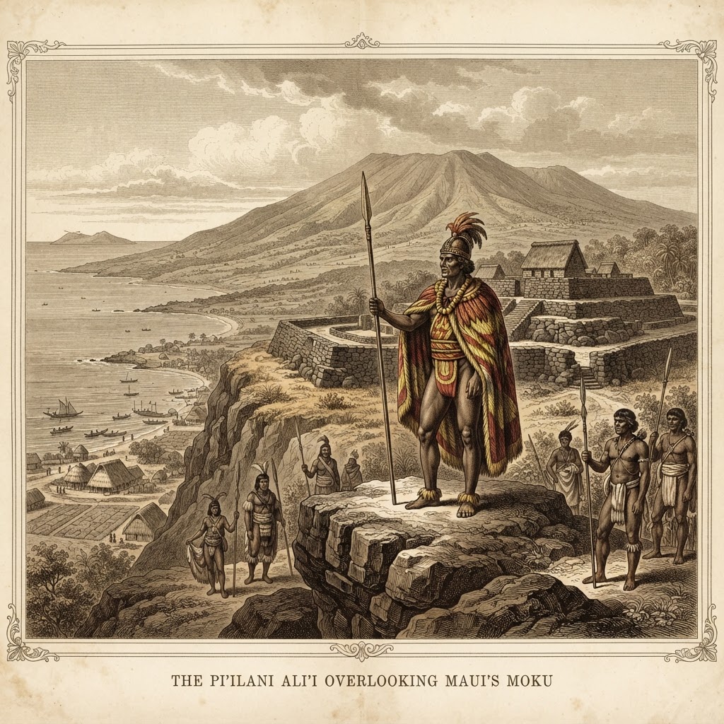
Maui was ruled by one of the most powerful chiefly dynasties in the archipelago — the Pi'ilani line. In the 16th century, the mo'i Pi'ilani unified the island under a single rule, ending generations of division between east and west Maui, and his reign became the measure against which later Maui chiefs were judged. He built the great Pi'ilanihale Heiau in Hāna — still the largest surviving heiau in Hawai'i — and the road and trail network that connected the island's moku, including the route that ran from Hāna over the south slope of Haleakalā down to the Kihei coast. Under Pi'ilani, the Moku ʻO Kula and its ahupua'a, including Kama'ole, were integrated into a single island-wide system of tribute, labor, and resource management.
Pi'ilani was succeeded by his son Kiha-a-Pi'ilani, whose reign is remembered for the completion of the island's trail network and the continued prosperity of the land. The Pi'ilani line held Maui for several generations, and their authority reached into every ahupua'a through the ali'i ai moku and ali'i ai ahupua'a who governed on their behalf. For Kama'ole, this meant the land was never an isolated coastal strip but part of a system that ran from the mo'i's court down through the moku chief of Kula to the konohiki who managed the watershed day to day.
In the 18th century, Maui's power reached its peak under Kahekili II, a fierce and ambitious mo'i who expanded Maui's reach beyond its own shores — conquering O'ahu and parts of Moloka'i, and ruling a domain that rivaled Kamehameha's Hawai'i island. Kahekili was a warrior chief who enforced his authority through the kapu and through war, and his court drew tribute from across the islands. But his death in 1794 set off a struggle that would end Maui's independence. His son Kalanikūpule inherited the mo'i-ship but faced the rising power of Kamehameha I, who had already brought the war god Kūkā'ilimoku under his protection and was consolidating the islands one by one.
The decisive clash came at the Battle of Kepaniwai in 1790 (also called the Battle of ʻĪao), in the ʻĪao Valley of west Maui, where Kamehameha's forces — armed with Western cannon and muskets obtained from trade with British and American ships — overwhelmed Kalanikūpule's warriors. The battle was so bloody that the ʻĪao Stream was said to run red, and the name Kepaniwai means "the damming of the waters" — the bodies of the slain dammed the river. Though Kalanikūpule fought on for a few more years, Maui's independence was effectively broken. By 1795, Kamehameha had taken O'ahu as well, and Maui became part of the unified Kingdom of Hawai'i — the last independent chiefdom of Maui absorbed into the new order.
For Kama'ole, the fall of the Maui chiefs meant the end of a ruling line that had governed the island for centuries. The ahupua'a did not disappear — it continued to function under the new kingdom — but the ali'i who held it were now Kamehameha's appointees rather than the Pi'ilani line's, and the tribute that had flowed to the Maui mo'i now flowed to the king on Hawai'i island. Within a generation, the 1848 Māhele would privatize the land entirely, and the chiefly connection to the ahupua'a would be severed for good. But the memory of the Pi'ilani line — of a time when Maui was a sovereign chiefdom and Kama'ole was a link in its chain of authority — remains part of the land's story.
The Moku & Kula
Each island was divided into large districts called moku. Maui has 12 traditional moku, and each moku was further divided into ahupua'a. The ahupua'a were in turn split into three zones — mauka (mountain), kula (open farm land), and makai (coast) — and the majority of people lived and farmed in the kula section.
Kamaole sits within the Moku ʻO Kula, the upcountry-to-coast district of south Maui. The Maui Nui Ahupua'a Project — a collaborative signage program documenting the island's ancient land divisions — completed its first signs in Kula Kai (the Kihei coastal portion of the Moku ʻO Kula) in October 2019, followed by upcountry Kula signs in 2022. The project recovers the place names and moʻolelo (stories) that roughly 1,500 years of context had hidden when Westerners re-named the land.
South Kihei & Kamaʻole
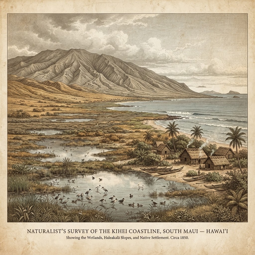
Long before Kihei became a beach town of condos and cafes, the area was known as Kamaʻole — a Hawaiian word meaning "barren." The coastal strand was a stretch of dryland, but it was bordered by rich wetlands and marshes. Until the 1960s, much of coastal south Maui was marshland, and old-timers remember small ponds dotting the coastline like pearls.
That productivity declined in the 1800s. Deforestation in the Kula highlands caused mass siltation and flooding, so Kihei's wetlands became less productive over time. The reefs, once kept healthy by the wetlands and the upland dryland forests above, suffered as the sponge-like uplands were cleared. Modern Kihei was born from the 1970 Kihei Civic Development Plan, which treated the marshland as developable ground and set the region on its path to a beach town — a story of overdevelopment that community groups still work to rebalance today.
The South Maui Community Plan
Every decade or so, Maui County writes a community plan for each region — a legally binding document that translates the island-wide general plan into specific land-use rules for a single area. The South Maui Community Plan covers Kihei, Wailea, and Mākena, and it is the document that decides where homes, hotels, parks, and roads may go, how tall buildings may rise, and how much growth the land and water can bear. The current plan was adopted in 1998 and updated in 2024, after years of public input.
The plan's central tension is growth. South Maui is where most of the island's visitor rooms and new housing are concentrated, and the 2024 update projects tens of thousands of new residents and visitors over the coming decades. Community advocates pushed hard for the update to rein in overdevelopment — to protect the last open coastal land, to require affordable housing alongside resort construction, and to force infrastructure (roads, water, parks, schools) to keep pace with building rather than lag behind it. The plan also elevates shoreline setbacks, watershed protection, and the restoration of coastal wetlands that once filtered runoff before it reached the reef.
For an ahupua'a-minded community, the community plan is the closest modern equivalent of the konohiki's authority over the land — it is where the whole watershed, mauka to makai, is supposed to be kept in balance. Whether it succeeds depends on enforcement, on the county's willingness to say no to projects that exceed the plan, and on residents who show up to the hearings the way the old ahupua'a's people would have shown up to the hula kō.
The Kihei Wastewater Treatment Plant & the Injection-Well Problem
The Kihei Wastewater Reclamation Facility, operated by the County of Maui along South Kihei Road, treats the town's sewage and injects the treated effluent underground through a set of injection wells. The idea was that the porous lava rock would filter the water as it seeped down toward the freshwater aquifer. It does not. Tracer-dye studies confirmed that a portion of the injected effluent travels laterally through the groundwater and emerges offshore at the reef — a slow, steady seep of nutrients and bacteria into the very waters where residents swim, snorkel, and fish.
The problem is not unique to Kihei — the same finding shut down the Lahaina injection wells after the EPA and community groups proved the effluent reached the ocean — but South Maui's case is urgent because the plant sits directly above a reef tract that the community has spent decades trying to protect. Nutrient-rich effluent feeds algal blooms that smother coral, and bacterial contamination triggers the brown-water advisories that close Kihei beaches after rain. For an ahupua'a that runs mauka to makai, the injection wells are a direct, documented line from the town's waste to the ocean's health.
Recommendations for upgrades: Community groups, the EPA, and the County have identified a clear set of fixes that would cut the seepage and protect the reef:
- Reworked effluent disposal: Move away from injection wells toward high-level reuse — treating effluent to R-1 reclaimed-water standards and distributing it for irrigation of parks, golf courses, and median strips, so the water stays on land instead of seeping to the sea.
- Advanced treatment: Add nutrient-removal (denitrification) and UV disinfection stages so that whatever effluent remains is far lower in nitrogen, phosphorus, and pathogens before it reaches the ground.
- Injection-well monitoring & closure: Expand the dye-tracer and nearshore water-quality monitoring program, and phase out the highest-risk wells closest to the shoreline as reuse capacity comes online.
- Wetland restoration: Reconnect the old Kihei coastal wetlands as a natural biofilter, so stormwater and treated effluent pass through vegetation and sediment before reaching the reef — restoring the sponge the coast lost.
- Capacity & I/I reduction: Fix inflow-and-infiltration in the sewer lines so stormwater stops overwhelming the plant, and size any expansion to the community plan's growth caps rather than to developer demand.
None of this is speculative — the Lahaina settlement and the Clean Water Act give the county both the legal duty and the funding pathway to do it. For Kamaole, closing the injection-well-to-reef line is one of the most direct ways to honor the ahupua'a principle that what happens mauka must not poison what lives makai.
The Kihei Drainage & Flood Control System
Kihei sits on a low coastal plain beneath the steep, bare slopes of Haleakala Ranch's upcountry pasture. When a kona storm drops heavy rain on those denuded hills, the water does not soak in — it sheets off the hard-packed soil, funnels down the old gulches (Kanahā, Waipuʻilena, ʻĀpua), and arrives at the flat town all at once. For most of the 20th century there was almost nothing to slow it: the wetlands that once absorbed the flow had been drained and filled for the 1970 Kihei Civic Development Plan, and the new streets and parking lots added acres of impervious surface that sent the runoff straight to the ocean instead of into the ground.
The result was chronic flooding. South Kihei Road would close under brown water, homes and businesses took on runoff, and the same floodwater carried motor oil, sediment, and bacteria onto the reef — triggering the brown-water advisories that close beaches after every big storm. The county and the Natural Resources Conservation Service responded with a network of drainage ways, retention basins, and flood channels built from the 1980s onward: the Kihei Drainage Ditch and the concrete-lined channels along ʻĀpua and Waipuʻilena gulches intercept the mauka flow and hold it in basins so it releases slowly rather than in a wall.
The system works — mostly. It keeps the worst flooding off South Kihei Road and cuts the sediment pulse to the reef. But it is also a single-purpose, hard-engineered system: it moves water fast, it does not clean it. The basins fill with silt and need constant dredging, the channels are concrete that offers no habitat and no filtration, and in the largest storms the system is still overwhelmed. Community groups have long argued for a softer, ahupua'a-style approach — restoring the coastal wetlands as floodable parks that double as biofilters, retrofitting the channels with vegetation and sediment traps, and requiring new development to detain its own stormwater on site rather than dumping it into the public system.
The 2024 South Maui Community Plan begins to move in that direction, calling for green stormwater infrastructure, restored wetlands, and development setbacks from the gulches. For an ahupua'a that runs mauka to makai, the drainage system is the literal connective tissue — and the difference between a storm that feeds the reef and a storm that buries it.
The South Maui Watershed Plan
A watershed is the whole slope — every drop that falls between the mountaintop and the reef follows the same gravity to the same shore. The South Maui Watershed Plan, developed by the County of Maui with state and federal partners, treats the Kihei-Wailea-Mākena coast as one connected system rather than a set of separate problems. Where the community plan governs land use, the watershed plan governs water: where it comes from, where it goes, and what it carries with it.
The plan's foundation is the mauka forests. The East Maui watershed — the native koa and ʻōhiʻa forest above Kula — is the island's sponge, capturing fog and rain and releasing it slowly into the aquifers that supply Kihei's drinking water. When that forest is healthy, the streams run clear and the aquifer recharges. When it is degraded by feral pigs, invasive plants, or cattle grazing, the sponge fails: floods run off fast, the aquifer drops, and the reef gets buried in sediment. So the plan's first priority is forest protection and restoration in the upcountry headwaters, led by the East Maui and Leeward Haleakalā Watershed Partnerships that fence the feral animals and replant the native canopy.
Moving makai, the plan addresses the gulches and alluvial fans that carry stormwater from the ranch lands down to the coastal plain — the same flow the drainage system tries to manage. It calls for restoring the natural floodplains, reconnecting the wetlands that were filled for development, and retrofitting the hard channels with sediment traps and vegetation so the water is cleaned before it reaches the ocean. At the shore, the plan ties directly to reef water quality: reducing the nutrient and sediment load that fuels algal blooms and coral disease, and coordinating with the wastewater plant upgrades so the injection-well seepage is addressed at the same time as the stormwater.
What makes the watershed plan different from the community plan is its scale and its science. It is built on hydrology models, water-quality monitoring, and the understanding that a single ahupua'a cannot be managed in pieces — the forest, the ranch, the town, and the reef are one system, and saving the reef means healing the slope above it. It is, in a real sense, the konohiki's old knowledge written in modern terms: care for the mauka so the makai may live.
Sources & Further Reading
The Ahupua'a System: Traditional Hawaiian Land Management
Nation of Hawai'i
Overview of the ahupua'a as a self-sustaining land division organized by water flow from mauka to makai.
Hawaii's ancient land management system
BBC Travel
Carbon-dated to over 1,000 years old; per-acre taro yields five times dryland farming; the modern restoration movement.
The Hawaiian ahupua'a land use system: its biological resource zones and challenge for silvicultural restoration
ResearchGate (peer-reviewed)
Academic study of the biological resource zones within an ahupua'a, using Kahana Valley as a case study.
Maui Nui Ahupua'a Project — Moku ʻO Kula
Maui Nui Ahupua'a Project
Collaborative signage program documenting Maui's 12 moku and their ahupua'a; Kula Kai (Kihei) signage completed 2019.
Ahupua'a of Maui (map & index)
Hawaii DLNR / State Historic Preservation Division
Official reference listing the ahupua'a within each of Maui's moku.
Aha Moku Structure Handbook
Hawaii DLNR — Aha Moku
Describes the 12 moku of Maui and the traditional council system of resource governance.
The Hawaiian Chiefdoms: Political Organization of Pre-Contact Hawai'i
Hawaiian Encyclopedia
The ali'i hierarchy, the mo'i of each island, mana and genealogy, and the social stratification of chiefs, priests, commoners, and kauā.
The Konohiki: Traditional Hawaiian Land Managers
Hawaiian Encyclopedia
Explains the konohiki's role overseeing ahupua'a resources, labor, tribute, and water rights under the ali'i.
The Great Māhele of 1848
Hawaiian Historical Society
The 1848 land privatization that dissolved the shared ahupua'a system and replaced it with fee-simple parcels.
The Kapu System of Ancient Hawaii
Hawaiian Encyclopedia
The sacred laws governing resource use, conduct, and ecological balance within the ahupua'a, abolished in 1819.
About Kihei — History of South Maui
Kihei Community Association
Until the 1960s much of coastal south Maui was marshland dotted with small ponds.
A brief history of wetlands in Kihei
Save the Wetlands
1800s Kula highland deforestation caused siltation that reduced Kihei's once-rich wetlands.
Hidden South Maui: Cultural Landmarks That Shape the Coast
Sotheby's International Realty
Kihei was known as Kamaʻole, meaning 'barren' in Hawaiian, before modern development.
Maui Island History (Kihei Civic Development Plan, 1970)
County of Maui
County planning history documenting Kihei's transformation from marshland to beach town.
Lahaina Injection Wells & the Clean Water Act (Maui v. Hawaii Wildlife Fund)
U.S. EPA / Earthjustice
Tracer-dye studies and the Supreme Court case confirming that injection-well effluent reaches the ocean via groundwater, requiring Clean Water Act permits.
Kihei Wastewater Reclamation Facility — Reuse & Effluent Management
County of Maui Department of Environmental Management
County facility background on the Kihei plant, its injection wells, and the R-1 reclaimed-water reuse program proposed to reduce ocean seepage.
South Maui Community Plan (1998, updated 2024)
County of Maui Planning Department
The legally binding land-use plan for Kihei, Wailea, and Mākena — growth caps, shoreline setbacks, watershed protection, and affordable housing rules.
Kihei Drainage & Flood Control — NRCS Watershed Plan
U.S. Department of Agriculture, Natural Resources Conservation Service
Federal watershed program that funded Kihei's drainage ways, retention basins, and flood channels to intercept mauka storm runoff before it reaches the coastal plain and reef.
Kihei Flooding & Stormwater Management Studies
County of Maui Department of Public Works
County engineering background on Kihei's flood zones, drainage infrastructure, sediment basins, and the brown-water advisories linked to storm runoff.